Menu
Menu

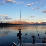
People come from across the globe just to capture a scene from our great Lake Tahoe. Some visit to walk the trails along its shore. Others arrive to bike the surrounding highway, and some of the less active just drive around and park where there is a clearing, such as West Shores Vikingsholm or East Shores Highway 431 pullout. There is a saying in the Truckee-Tahoe area: The higher you get, the higher you get. This saying could be in reference to the views gained at higher elevation around the lake. Whether it is in summer on the Tahoe Rim Trail and the PCT or in winter traveling the crest with skis, snowshoe or snowmobile, the higher you get, the better the scene. In my 16 odd years in the Tahoe area the grandeur of the lake has captured me most along Tahoes North Shore, accessed in the summer via the Tahoe Rim Trail from Hwy 267 east to the top of Martis Peak, and then up into the wilderness boundary.
In winter you can use the same route on a snowmobile (by foot for the hearty) or by ski from Rose Knob. This is arguably the longest view of the lake and on the clearest days it seems as though the waters may spill out and crash upon you. This sensation is brought about by the way the north shore spreads its arms from east to west and lays out to the south, bordered by the taller 10,000 foot peaks of the Southern Sierra. The peaks along the west side of the lake are close to the shore. They rise a cool 3000 feet above the clear deep waters, providing a perch like view, although not as long as from the North Shore.
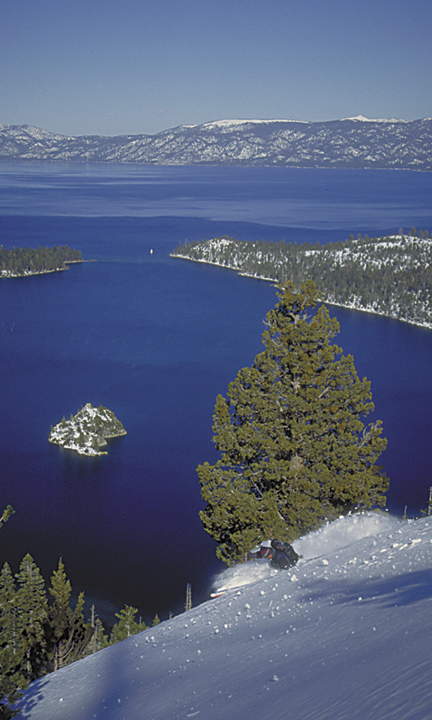
The peaks running north to south are Homewood (Ellis), Rubicon, Jakes, Granite Mt., Tallac and Maggies The outlook from Rubicons craggy point towers above the water tempting the bravest traveler to break into a swan dive and glide from peak to water. The scene is relatively similar from all the peaks of the west shore, but none the same. They are accessed most easily in winter aboard skis or splitboard. The terrain of the west shore is steep and heavily treed detouring most snowmobiles and snowshoes, yet providing great powder tree skiing. To get to Rubicon simply follow the neighborhood roads to the top then park- sometimes the grumpy person will ticket you, so be discrete. To access the other peaks, park along Highway 89 in line with your mountain of choice. Unless it is the day of a storm there is always a skin track in place. The shortest hike of all the West Shore peaks is Maggies, with a stunning view of the classic and most photographed Emerald Bay (see photograph).