Menu
Menu

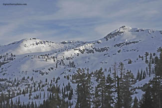
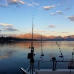
It has many nice north facing descents with cliffs and chutes and a steep palisade along its east ridge. There is evidence of large avalanches coming from the palisade. Once you cross the third lake follow the drainage north west toward the saddle that leads to Aloha Basin. The PCT crosses this section. In summer the same adventure can be taken along the PCT from Echo Lake, although during the summer season the circus of tourism clangs and chimes with extravagant toys and booming voices. Winter is the sound of silence accompanied by the wind, critters and following water.
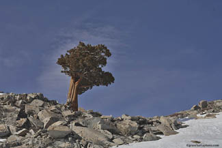
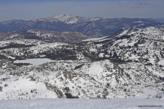
Aloha Lakes Basin is a special place, and is a part of the Desolation Wilderness. It is protected, and a limited amount of permits are available. Stay in the saddle and continue to head northwest and your travel will remain relatively flat. If you wish to descend on skis into the basin, you can stay a little south toward Ralston when heading to the saddle. This allows for about a 1200 foot low angle descent into the Horsetail Falls drainage. Briefly, the ascent from Horsetail Falls trailhead is shorter than from Echo Lake. However, the trail is steep, often snow less, and hard to follow. Aloha Basin and the surrounding areas are full of small lakes and ancient Juniper trees. The Junipers are gnarled by the storms yet grow magnificently straight out of the pearl white granite, cast against sterile blue sky. This is a timeless palace, tucked under the great Pyramid Peak and its craggy ridge that runs north, twisting, falling, and rising into the Crystal Range, aptly named, “Pyramid”.
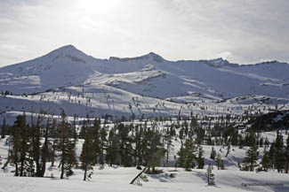
Pyramid Peak is the highest in Desolation Wilderness at 9983 feet. Aloha Lakes Basin has views to the south as far as the eyes will perceive and mountainous desolate scenes to the northeast up the Aloha Lakes Basin. This is a place man could stay in peace and grow old enough to reason with the wealth of wisdom that percolates out of the babbling brooks, cold granite stone and noble Junipers.
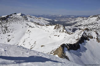
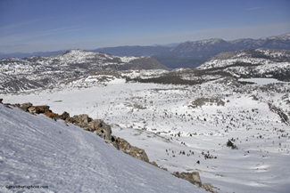
You can ascend any part of Pyramid Peak and its joining ridge. The south ridge of Pyramid is the most gentle and most popular, although somewhat out of the way from the Echo approach. Once the summit is gained the 360 degree view is stunning. There is nothing obstructing the view of Strawberry far below, nor the views of Kirkwood, Bear Valley, Ebbets Pass, Sonora Pass and much more to the south. To the west the blue-green foothills roll into the invisible ocean. To the east Fallen Leaf Lake appears to have fallen, literally, out of the Tahoe Basin. If you have made it here you have walked a long way and you can see Echo and the journey back. To the north you can see as far as the Sierra Buttes, Lassen Volcanic National Park and for the truly visually gifted, Mt Shasta.
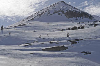
The ski descent is fairly steep, steep enough that falling is really not an option, but not deadly enough to call it extreme. If you descend the south side there is a bonus pitch down low that fills the basin between Ralston and Pyramid. It is steep with gully chutes, steep walls, silent tiny lakes and blind hills providing that lost feeling for hours. A more direct return, yet steeper and rockier, is down the north and east side of Pyramid into the Aloha Basin. This a more consistent pitch and a faster return to Echo. Once down off the summit simply follow the flowing hills back to the saddle from which you came. There is a nice glide down to the Echo Lakes with many ancient Juniper trees to swoop through, painted by the Tahoe blue sky line. This adventure is a leisurely 10-12 hours.